 Yes. Autumn is upon us once more and so, before it wraps its chilly, damp arms completely about us, we are to embark on Le Dash. Once again, we are to take advantage of the canny crossings across the channel from Dover. After close study of the various options provided by DFDS and Piano, we took up the latter's offer of a car return to Calais at a fantastic price of £59. This was obtained after applying a 'surprise' discount code obtained via an email. Neil had chanced his arm prior to me, the 'surprise' in his case being that the discount code was for the Fishguard-Cork crossing. I struck lucky and got £14 quid off.
 With the usual time constraints, fundamental to the three-day jaunt is spending the daylight hours cycling and not travelling. To this end we will leave Balham, gateway to France, on Thursday evening in Neil's voiture and hole up in a peculiar looking hotel down on Dover's frontage. This will set us up nicely for the 6.40am crossing so that we'll hopefully be in the cleats by 10am.
Balham, 20.30 hundred O'clock hours pm: All packed up after disassembling D's bike and shoving the panniers in the boot, we strapped on and headed, courtesy of N's shitnav through the maze of roads of South East London to find the way out. The somewhat exasperated Voice of Shitnav, flummoxed us all by directing us to Cat-ford as opposed to Cat-food.

But, ferries, what's left of them, are a great way to travel so, get on down there and snap up a deal!
After lining our stomachs with an industrial strength Full English, the Piano ferry dropped us off in Calais, from which we drove to handy Loon Plage to park the motor. In the very spot we'd left Neil's Saab a few years back we reassembled and reconfigured the bikes.
First stop was Cassell, atop of a random hillock that sat like a pimple upon the flatness of this corner of North East France. After an incline that merited three Michelin Chevrons, D located a bijou/rustic tea room overlooking the vast plains south towards Lille. The morning treats were, indeed, treat like and went down a treat.


The south side of the town, rather than provide a steep fast descent to make up for the crawl up, was a pain-in-the-butt cobbled road, one upon which Deuan, performing his now legendary party-trick, came a cropper.
On towards Lens but not before visiting the Indian War Memorial at Neuve Chappelle. The site displays the names 4742 Indian soldiers in the British Army who died in WW1 and whose remains, like those of thousands of others, were never found. Incredibly tragic. Incredibly tragic and sad as, next year, politicians will remind us that however appalling the war and loss of life was, it was necessary. Like hell it was.


The top of the ridge was littered with UXBs and the like. Neil observed that the grass was, however, remarkably well kept.
Leaving the memorial to head to Vimy, we continued to cross the crest of the ridge, passing more no-go areas until, through the trees, we spotted the well preserved trenches.


We left the ridge and hurtled through the gathering dusk of a beautiful evening to the hotel in Cuincy, just to the north west of Douai.
This turned out to be a clean and comfy motel style hotel - the chain known as Campanile, which sounds like the medical name given to someone with a psychotic love of the outdoors.
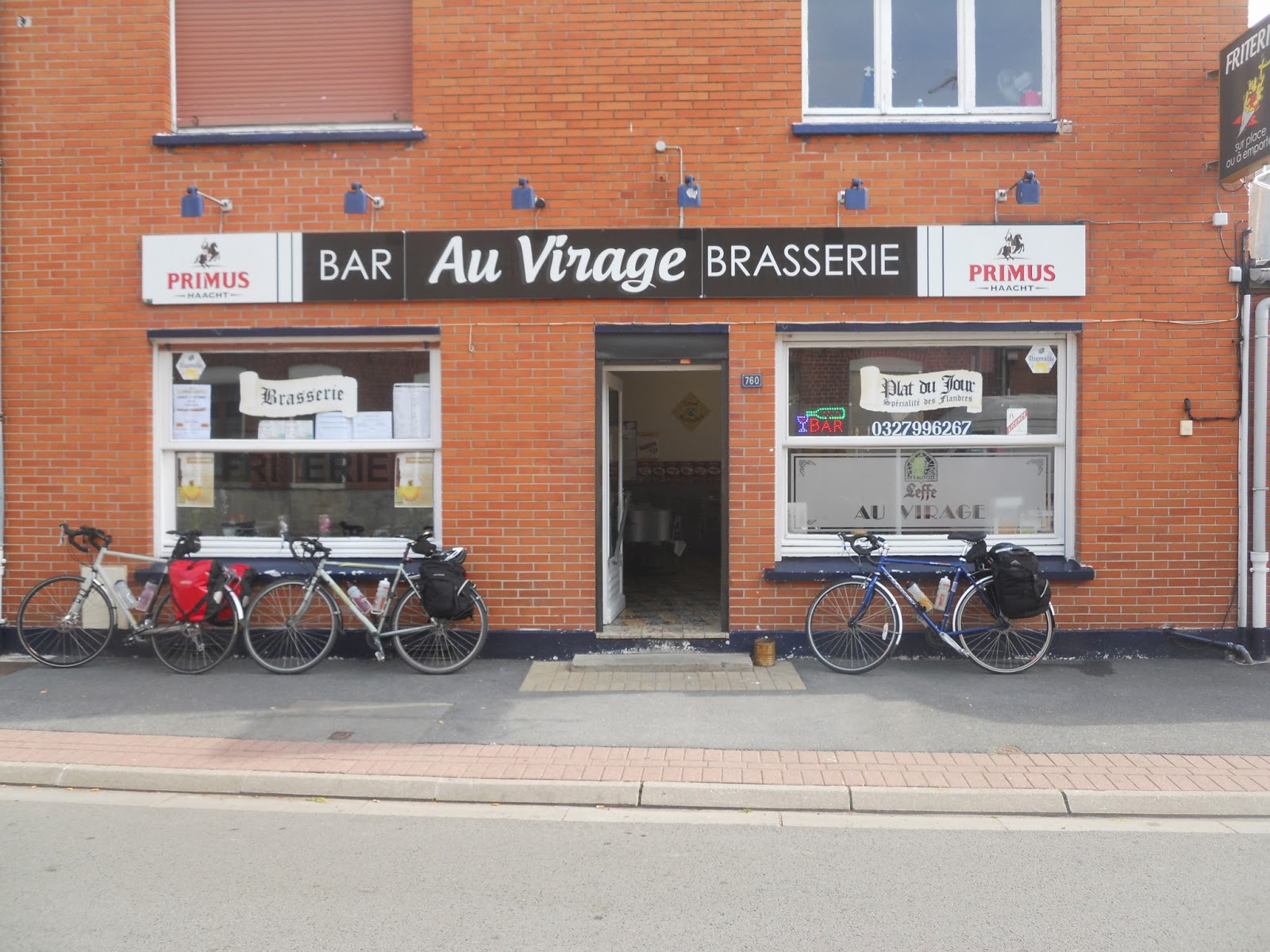
Once showered we explored the roundabout just outside the hotel and discovered a cheerful branch of 'Mr. Pizza' and got deservedly stuffed.
First stop was Cassell, atop of a random hillock that sat like a pimple upon the flatness of this corner of North East France. After an incline that merited three Michelin Chevrons, D located a bijou/rustic tea room overlooking the vast plains south towards Lille. The morning treats were, indeed, treat like and went down a treat.


The south side of the town, rather than provide a steep fast descent to make up for the crawl up, was a pain-in-the-butt cobbled road, one upon which Deuan, performing his now legendary party-trick, came a cropper.
On towards Lens but not before visiting the Indian War Memorial at Neuve Chappelle. The site displays the names 4742 Indian soldiers in the British Army who died in WW1 and whose remains, like those of thousands of others, were never found. Incredibly tragic. Incredibly tragic and sad as, next year, politicians will remind us that however appalling the war and loss of life was, it was necessary. Like hell it was.
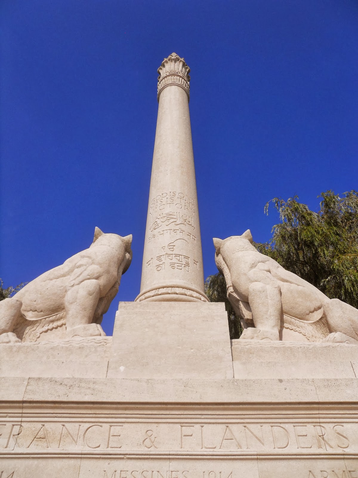


The roads in this neck of the woods required constant navigation stops so as to avoid Lens and to work our way through the 'burbs to get to Vimy Ridge and the spectacular Canadian War Memorial. Vast views from Vimy Ridge are at odds with its eerie silence and the live ammunition beneath.


Much of the area on the ridge to the west of the memorial was cordoned off:

The top of the ridge was littered with UXBs and the like. Neil observed that the grass was, however, remarkably well kept.
Leaving the memorial to head to Vimy, we continued to cross the crest of the ridge, passing more no-go areas until, through the trees, we spotted the well preserved trenches.


This turned out to be a clean and comfy motel style hotel - the chain known as Campanile, which sounds like the medical name given to someone with a psychotic love of the outdoors.
Once showered we explored the roundabout just outside the hotel and discovered a cheerful branch of 'Mr. Pizza' and got deservedly stuffed.
Here is a simple test: which of the following water features is the odd one out?


Yes, that's right, it's the canal. The others are clearly identifiable as rivers, what with the waterfalls, big bends and fast bits. Not too difficult that, was it.
From the hotel, it was easy to get to the Le Scarpe, a small river that headed east towards St Amand de Eaux. We just followed the D125 that ran past the hotel into the Northern reaches of Douai. Simply go over a railway line, simply hang a right and the Le Scarpe would be there. Simple.
There are a lot of canals in the French-Belgium border region. In fact, 'canal' is a Belgian word, meaning 'A fairly straight man-made waterway with occasional locks that definitely does not look like a river.' There are canals everywhere in Belgium, which is fortunate as Belgium would be even more boring but for them - the Belgians really do know how to take advantage of their flatlands. Unfortunately Germany also knew how to take advantage of Belgium's flatlands twice in the last century. I digress - I've gone off at a tangent - deviated - taken an alternative route.
The route was not quite as simple as it appeared on the map and we took a slight deviation, digressed, strayed from the beaten path, so to speak. Neil suggested/shouted, at one point, that we were 'some clean pack on our shelves', which I of course, ignored. What he had actually said, of course, was that we were 'circling back on ourselves'.


 We took a path down by the 'river' and headed 'west'. After a few hundred yards we entered the inexplicably built up area of the countryside. I flippantly, in answer to Neil's question as to where we were, said were were in a town that began with 'L'. I was sure we were on the right path despite the fact we were clearly going through the very urban inner city centre (completely the wrong/opposite direction) and not a cutesy rustic town. Still, this man was not for U-turns. I was convinced of my infallible navigation skills. But, I had to concede that I may I have made a slight error when faced with the combination of the following, one that flummoxed me.
A cheerful French man cheerfully explained to us where we were and finished off with a hearty guffaw when I showed Monsieur Bonhomme himself where I thought we were on my map. Tyres deflating rapidly are one sound but nothing compared to the sounds coming out of Neil and Deuan upon the hearing of this news. I was amok, at sea, flabbergasted at my discombooberation, navigation-wise.
I pulled myself out of the hole that had kindly opened up and swallowed me and between us, Neil and I found a route to get us back on track. After all the self-inflicted drama, we had gone 37km instead of 25km - about 7.5 miles extra.
The hour we lost required a short cut through the Lille Roubaix megalopolis and ditching the river route.

Once we had returned to the straight and narrow, it was time for a traditional snack of coffee and chips before passing through pleasant semi-rural areas along a very quiet D955, passing through villages with quaint names such as Bachy, Mouchin, Cysoing, and the aptly named - being on Lille's outskirts - Hem.

 After a joint operation between the old and the new - my dog-eared map and Neil's handheld, we made it across the megalopolis in quiet Saturday afternoon traffic.
Ypres was waiting for us like a favourite pair of slippers and chair after the long day in the saddle. We checked in to our favourite hut in Jeugstadion in the South Eastern sports quarter. Ypres is base camp for many British visitors - especially school trips - to the killing fields of Flanders. The town was completely flattened in WW1 but, using German reparation money, was reconstructed, brick by brick and the centrepiece is Cloth Hall occupying one corner of the town's cobbled old square.
We enjoyed the amenities of our expansive hut before heading into town, through the Menin Gate. At 8pm each eveing the last post is performed within the Menin Gate and has been done so since the 1920s save for a few years dueing WW2 where the ritual relocated to Surrey. We followed the sombre event with a few large Affligems in a bar playing rock music - backwards, considering the racket.

Yes, that's right, it's the canal. The others are clearly identifiable as rivers, what with the waterfalls, big bends and fast bits. Not too difficult that, was it.
From the hotel, it was easy to get to the Le Scarpe, a small river that headed east towards St Amand de Eaux. We just followed the D125 that ran past the hotel into the Northern reaches of Douai. Simply go over a railway line, simply hang a right and the Le Scarpe would be there. Simple.
There are a lot of canals in the French-Belgium border region. In fact, 'canal' is a Belgian word, meaning 'A fairly straight man-made waterway with occasional locks that definitely does not look like a river.' There are canals everywhere in Belgium, which is fortunate as Belgium would be even more boring but for them - the Belgians really do know how to take advantage of their flatlands. Unfortunately Germany also knew how to take advantage of Belgium's flatlands twice in the last century. I digress - I've gone off at a tangent - deviated - taken an alternative route.
The route was not quite as simple as it appeared on the map and we took a slight deviation, digressed, strayed from the beaten path, so to speak. Neil suggested/shouted, at one point, that we were 'some clean pack on our shelves', which I of course, ignored. What he had actually said, of course, was that we were 'circling back on ourselves'.
We arrived at Le Scarpe and, over the bridge, people were attending graves that were either in a pet cemetery or a graveyard for very short people.


 We took a path down by the 'river' and headed 'west'. After a few hundred yards we entered the inexplicably built up area of the countryside. I flippantly, in answer to Neil's question as to where we were, said were were in a town that began with 'L'. I was sure we were on the right path despite the fact we were clearly going through the very urban inner city centre (completely the wrong/opposite direction) and not a cutesy rustic town. Still, this man was not for U-turns. I was convinced of my infallible navigation skills. But, I had to concede that I may I have made a slight error when faced with the combination of the following, one that flummoxed me.
 |
| ocean going barges in dry dock |
 |
| Two towns not actually on my map |
I pulled myself out of the hole that had kindly opened up and swallowed me and between us, Neil and I found a route to get us back on track. After all the self-inflicted drama, we had gone 37km instead of 25km - about 7.5 miles extra.
The hour we lost required a short cut through the Lille Roubaix megalopolis and ditching the river route.


Ypres was waiting for us like a favourite pair of slippers and chair after the long day in the saddle. We checked in to our favourite hut in Jeugstadion in the South Eastern sports quarter. Ypres is base camp for many British visitors - especially school trips - to the killing fields of Flanders. The town was completely flattened in WW1 but, using German reparation money, was reconstructed, brick by brick and the centrepiece is Cloth Hall occupying one corner of the town's cobbled old square.
We enjoyed the amenities of our expansive hut before heading into town, through the Menin Gate. At 8pm each eveing the last post is performed within the Menin Gate and has been done so since the 1920s save for a few years dueing WW2 where the ritual relocated to Surrey. We followed the sombre event with a few large Affligems in a bar playing rock music - backwards, considering the racket.
With just 38 miles to do and 5 hours to do them in, we could take this warm, sunny day nice and easy. I'd been told off good and proper about bungling and negligence the evening before and so I was scrupulously attentive to my map. Add to that, the only elevation we were going to come against would be the ramp onto the boat. Highlight of the day was the waffles and slagroom in Poperinge.

Slagroom is not the VIP lounge of a West End nightclub; it is simply whipped cream, though I would expect one would probably find slagroom in the VIP lounge of a West End nightclub.
After scoffing the treats we passed through some pleasant agricultural land some of which was devoted to hop farms.

In no time at all, after zooming through more delightfully named towns and villages on the N308/D17 - Watou, Houtkerque (my guess that means 'High Church'), Herzeele, Wormhout, Esquelbecq and Pitgam, we arrived back in the equally oddly named Loon Plage. Unfortunately, like much of Belgium and this part of France, Wikipeadia devotes just nine words to Loon Plage so one can only guess as what the name means. Perhaps, Moon Beach.